 Loading... Please wait...
Currency Displayed in

- Home
- Maps By Sport
- Canoe Maps Canada
- White River Provincial Park & Area
Categories
Related Products

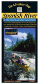
White River Provincial Park & Area

Hover over image to zoom
)
Product Description
One of Ontario's few remaining easily accessible wilderness white water paddling routes. Starting at the Town of White River on Hwy 17 north of Wawa, this map shows details of the 145-kilometre route across and down the Canadian Shield to Lake Superior and Pukaskwa National Park.
This route was closed for a number of years due to construction of dams and hydroelectric stations at several points along the river, but while a short section of the lower river is now more lake-like than river, the overall effect is still a great route. And so, now that construction is over and the area settled down again, we're updating and releasing a new version in spring 2021, with the encouragement of custodians White Lake Provincial Park and Pukaskwa National Park. NOTE: Due to demand for existing Park activity and Covid limitations on staffing, Ontario Park & Parks Canada managements have indicated they will not be able to officially open the route this year after all. They are now aiming for spring 2022. Therefore this map cannot be reliably published until the route is fully prepared (campsites, portages, reservation system, capacity limits, shuttle services, etc.). Disappointing but thems the breaks.
Highlights include the Town of White Lake (home of famous and quite real Winnie-the-Pooh bear), White Lake Provincial Park at about the halfway point (the Park can serve as a great base of operations), thundering Umbata Falls & portage, the high suspension bridge used for the Coastal Hiking Trail above Chigamiwinigum Falls (say that fast 5 times), and of course, the fabulous Lake Superior coast as you paddle north to your take-out at Pukaskwa National Park's Hattie Cove (lots of superb hiking trails and a campground to enjoy there). This route remains a worthy combination of flatwater lake and river paddling, light and heavy whitewater sections and some "ocean-like" paddling on the inland sea, Lake Superior.
Our 1:50,000 scale, completely original (like all the others) topographic map has unprecedented terrain, vegetation and water detail, and highlights access points, campsites, portages, rapids, falls, dams, plus many other features essential to travellers. The back side includes a complete description of the route, natural and human history, safety concerns, contact info and colour photos.
Of course, it's waterproof. And a good thing too - did you see the size of that waterfall!