Loading... Please wait...
Currency Displayed in
Categories
Canada Topographic Index System
Canada Topographic Index System
How The Canada Topographic Index System Maps Work
Topographic maps produced by Natural Resources Canada conform to the National Topographic System (NTS) of Canada. The National Topographic System provides general-purpose topographic map coverage of the entire Canadian landmass. These maps depict, in detail, ground relief, drainage, forest cover, administrative areas, populated areas, transportation routes and facilities, and cultural features.
They are available in two standard scales, 1/50 000 and 1/250 000. The maps show a geographic grid (longitude and latitude) and a Universal Transverse Mercator (UTM) grid (kilometres). The area covered by a given map sheet is determined by its latitude and longitude. Since the National Topographic System uses a standard numbering system, knowing the map number allows you to quickly identify adjacent map sheets.
The 1/250 000 scale maps (1 cm equals 2.5 km) are identified by a combination of numbers and letters, from A through P (e.g. 12A, below in yellow). The 1/250 000 blocks are further sub-divided into sixteen segments (1 to 16), forming blocks used for 1/50 000 scale mapping (1 cm equals 0.5 km).

Canadas UTM system
To understand how the projection works, imagine the Earth as an orange, with all geographical features and the parallels and meridians already drawn in. Now imagine taking a knife and, after slicing off small circles at the poles, making a straight north-south cut in the peel of the orange and repeating this north-south cut, at equal intervals, until 60 strips or zones have been detached (see Figure 1, below).
Each of these zones will then form the basis of a separate map projection. The flattening may be envisioned by again considering the detached zone as a strip of orange peel placed on a level surface. By depressing its centre, one could force the peel to flatten until all of it touches the smooth surface. This flattening action results in a slight distortion of the geographical features within the zone, but because the zone is relatively narrow, the distortion is small and may be ignored by most map-users.
Because the globe is 360° in circumference, a division into sixty vertical zones gives each zone the width of 6° of longitude. By international usage these zones have been numbered 1 to 60. Sixteen of the zones, bearing numbers 7 to 22, cover Canada, as shown in Figure 2, below.
Once the zone has been flattened onto a level surface it can be divided into a basic set of map sheets of a convenient size. These basic sheets are divided further into sections and each section is published as a map of a larger scale. In Canada this is done to produce the 1/250 000 and 1/50 000 scale maps, which are the two scales of the National Topographic System. By convention, the edges of most maps fall along parallels and meridians. In the far north, where zones are narrow, medium- and small-scale maps may show parts of more than one zone. The important feature of the Universal Transverse Mercator Projection is that the zones are standard and readily identifiable, so that an area may easily be designated as lying within a specific zone.
Canada topographic Scale system
Maps are made to scale. In each case, the scale represents the ratio of a distance on the map to the actual distance on the ground. For example, if 2 cm on a map ...
represents 1 km on the ground ...
the scale would be 2 cm = 1 km, or...
Reading Distances on a Map
Use the Scale Bar found at the bottom of every National Topographic Systen (NTS) map to determine distances between points or along lines on the map sheet. (Note, the example below is not to scale.)
Use the secondary division on the left of the Scale Bar for measuring fractions of a kilometre. The measurement indicated is about 7.5 kilometres or 7 500 metres.
Find out more about the National Topographic System, UTM Projection, and Symbols used on NTS maps. http://maps.nrcan.gc.ca/topo101/scale_e.php
New Products
-
-
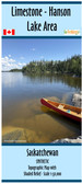
 Limestone - Hanson Lake Area $22.00
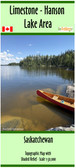
 -
-
-