Loading... Please wait...

Categories

Spain Portugal itmb Travel Map

Hover over image to zoom

  • Spain with Portugal at 1:900,000 on a large, double-sided, indexed map printed on waterproof and tear-resistant plastic paper. Altitude colouring presents the topography of the Iberian Peninsula, with plenty of names of sierras, etc. However, elevation tints are graded in the legend as shown in feet, peak heights are given on the map in metres, and the two do not match even when converted!

The map divides the region east/west with hardly any overlap between the two sides and shows its road and rail networks, stressing motorway and principal routes. Various places of interest are highlighted. The map has faint latitude and longitude lines at intervals of 1°.
  • Spain with Portugal at 1:900,000 on a large, double-sided, indexed map printed on waterproof and tear-resistant plastic paper. Altitude colouring presents the topography of the Iberian Peninsula, with plenty of names of sierras, etc. However, elevation tints are graded in the legend as shown in feet, peak heights are given on the map in metres, and the two do not match even when converted!

The map divides the region east/west with hardly any overlap between the two sides and shows its road and rail networks, stressing motorway and principal routes. Various places of interest are highlighted. The map has faint latitude and longitude lines at intervals of 1°.p
  • Spain with Portugal at 1:900,000 on a large, double-sided, indexed map printed on waterproof and tear-resistant plastic paper. Altitude colouring presents the topography of the Iberian Peninsula, with plenty of names of sierras, etc. However, elevation tints are graded in the legend as shown in feet, peak heights are given on the map in metres, and the two do not match even when converted!

The map divides the region east/west with hardly any overlap between the two sides and shows its road and rail networks, stressing motorway and principal routes. Various places of interest are highlighted. The map has faint latitude and longitude lines at intervals of 1°.
ITMB
$12.95
SKU:
IT413721
Weight:
0.20 KGS

 Product Description

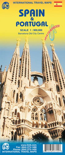
1:900,000 scale 2nd Edition, double-sided. This is actually the third edition of Spain, but combined with Portugal, is the second. The Iberian Peninsula remains one of the most visited and travelled parts of Europe. This updated edition is not significantly different from the previous edition; for example, we have retained the same cover picture and pricing structure. Both countries have invested heavily in road improvements since joining the EU and this map shows the most recent improvements. We have shown several construction projects as being underway; these may take several years to complete, but they show two countries moving steadily ahead. The map also includes a basic inset map of the Canary Islands (for better detail, please see ITM’s Canary Islands Travel map). We have printed this edition on durable ITM waterproof plastic paper, so it should stand up to rigorous use.

Spain with Portugal at 1:900,000 on a large, double-sided, indexed map printed on waterproof and tear-resistant plastic paper. Altitude colouring presents the topography of the Iberian Peninsula, with plenty of names of sierras, etc. However, elevation tints are graded in the legend as shown in feet, peak heights are given on the map in metres, and the two do not match even when converted!

The map divides the region east/west with hardly any overlap between the two sides and shows its road and rail networks, stressing motorway and principal routes. Various places of interest are highlighted. The map has faint latitude and longitude lines at intervals of 1°.

 Find Similar Products by Category

You Recently Viewed...


newsletter

Copyright 2024 GoTrekkers. All Rights Reserved.
 Sitemap | Ecommerce Website Design by High Country Web Design.