 Loading... Please wait...
Currency Displayed in
- Home
- Travel Maps
- Madagascar itmb Travel Map
Categories
Related Products
-
 Albania itmb Travel Map $9.95
 -
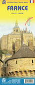 France itmb Travel Map $9.95
 -
 Mongolia itmb Travel Map $9.95
 -
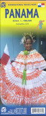 Panama itmb Travel Map $9.95
 -
 Turkey itmb Travel Map $9.95

Madagascar itmb Travel Map

Hover over image to zoom
)
Product Description
ITMB map of Madagascar scale 1:1,000,000 one of the last maps left available of Madagascar with insert for Antananarivo
Madagascar at 1: 1,000,000 on an indexed, double-sided map from ITMB with a large, clear street plan of central Antananarivo. The maps divides the island north/south with a small overlap between the sides. Topography is presented by bold altitude colouring and spot heights, both in feet. Graphic indicate swamp, wetland and mangrove areas and salt pans. National parks and other protected areas are highlighted.
The map shows the country’s road network, indicating paved and unsurfaced secondary roads, plus selected tracks. Driving distances are shown on main routes and locations of petrol supplies are marked. Also shown are railway connections, domestic airports and aerodromes/landing fields, and internal administrative boundaries with names of the provinces. Symbols indicate various places of interest, including locations with tourist accommodation, campsites, beaches and surfing sites, historical and archaeological sites, etc. Latitude and longitude lines are drawn at 2° intervals. Each side has a separate index.
Coverage includes Comoros Islands and Mayotte with ferry routes between the islands and to Madagascar. Also provided is a large, clear street plan of central Antananarivo indicating main places of interest, hotels, various facilities, etc.