Loading... Please wait...

Categories

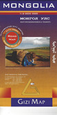
Mongolia itmb Travel Map

Hover over image to zoom

  • Thinking back, it seems hard to believe that we have sold through five editions of Mongolia maps. Of course, it is a popular travel destination, and reliable information is now much more readily available than was the case when we first started mapping this vast and largely undeveloped desert country. I think it is fair to say that the main road network is pretty much fixed in position, but secondary roads tend to be tracks that follow diverse paths towards obscure destinations. Regardless, it is a lovely country to visit, with lots to see and friendly people. We’ve updated the Ulaanbaatar capital city inset map, noting the train ticketing office (which isn’t in the train station), several museums, various temples, and the Canadian embassy. Why in the world does Canada have an embassy in Mongolia?
  • Mongolia on a double-sided, indexed map at 1:1,785,000 from ITMB with altitude colouring to show the country’s topography, plus a large street plan of central Ulaanbaatar annotated with hotels and places of interest. All place names are shown transliterated. 

The map divides the country east/west with a very generous overlap between the sides. Topography is shown by bold altitude colouring with graphics for swamps, glaciers, sand dunes, water wells, etc. National parks and protected areas are highlighted. Road network indicates partially paved and unpaved roads, includes selected tracks and shows locations of border crossings from Russia or China and petrol stations. Driving distances are shown on main and many local routes. Railway lines are included and domestic airports are marked. The map also shows internal administrative boundaries with names of the provinces and highlights various places of interest. Latitude and longitude lines are drawn at 2° intervals and each side has a separate index. 

A large, clear street plan shows the town centre of Ulaanbaatar, highlighting several hotels, foreign embassies, and various places of interest. Also provided is an inset showing the county's natural zones (taiga, steppe, desert, etc).
ITMB
$12.95
SKU:
IT294614
Weight:
0.20 KGS

 Product Description

Thinking back, it seems hard to believe that we have sold through five editions of Mongolia maps. Of course, it is a popular travel destination, and reliable information is now much more readily available than was the case when we first started mapping this vast and largely undeveloped desert country. I think it is fair to say that the main road network is pretty much fixed in position, but secondary roads tend to be tracks that follow diverse paths towards obscure destinations. Regardless, it is a lovely country to visit, with lots to see and friendly people. We’ve updated the Ulaanbaatar capital city inset map, noting the train ticketing office (which isn’t in the train station), several museums, various temples, and the Canadian embassy. Why in the world does Canada have an embassy in Mongolia?

Mongolia on a double-sided, indexed map at 1:1,785,000 from ITMB with altitude colouring to show the country’s topography, plus a large street plan of central Ulaanbaatar annotated with hotels and places of interest. All place names are shown transliterated. 

The map divides the country east/west with a very generous overlap between the sides. Topography is shown by bold altitude colouring with graphics for swamps, glaciers, sand dunes, water wells, etc. National parks and protected areas are highlighted. Road network indicates partially paved and unpaved roads, includes selected tracks and shows locations of border crossings from Russia or China and petrol stations. Driving distances are shown on main and many local routes. Railway lines are included and domestic airports are marked. The map also shows internal administrative boundaries with names of the provinces and highlights various places of interest. Latitude and longitude lines are drawn at 2° intervals and each side has a separate index. 

A large, clear street plan shows the town centre of Ulaanbaatar, highlighting several hotels, foreign embassies, and various places of interest. Also provided is an inset showing the county's natural zones (taiga, steppe, desert, etc).

 Find Similar Products by Category

You Recently Viewed...


newsletter

Copyright 2024 GoTrekkers. All Rights Reserved.
 Sitemap | Ecommerce Website Design by High Country Web Design.