 Loading... Please wait...
Currency Displayed in
- Home
- Travel Maps
- South America Southern Travel Map
Categories
Related Products
-
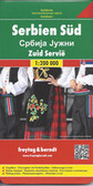 Serbia South Travel Map $9.95
 -
-
-
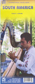 South America Travel Map $9.95
 -


South America Southern Travel Map

Hover over image to zoom
)
Product Description
ITMB double-sided, folded road map for the southern section of South America on a scale of 1:2,800,000 with detailed information on Magellan's voyage, Patagonia, Tierra del Fuego, Chile's Carreterra Austral, Argentina's Perito Morena Glacier, Straits of Magellan, Robinson Crusoe and Islas Malvinas and indexes. Map also has listed Numbered Protected Areas for Brasil, Paraguay, Argentina and Chile. Map features inset 6"x3" of Isla Robinson Crusoe. Best quality map of its kind to buy for travelling to South America Southern.
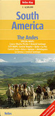
Southern South America at 1:2,600,000 in a series of three double-sided, indexed maps from ITMB, dividing the continent north/south and providing separate coverage of the Andes. Altitude colouring shows the topography and national parks or protected areas are highlighted.
The maps present an overview of the continent’s road and rail networks and indicate local domestic airports. Various places of interest are highlighted, some accompanied by brief notes. Altitude tints, varying in colouring between the three maps, show the continents topography and numerous tributaries of the Amazon are named.
*In this title:* double-sided map, with a separate index of localities for each side. The map shows the road and rail networks, and indicates local landing strips in the more remote parts of the interior. Important places of interest are highlighted. An inset has an enlargement for Isla Robinson Crusoe. Latitude and longitude lines are drawn at 1º intervals.