 Loading... Please wait...
Currency Displayed in
- Home
- Travel Maps
- Serbia South Travel Map
Categories
Related Products
-
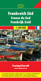 France South Travel Map $9.95
 -
 Serbia North Travel Map $9.95
 -
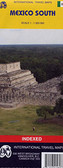 Mexico South Travel Map $9.95
 -
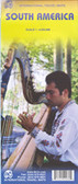 South America Travel Map $9.95
 -
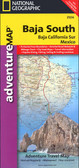 Baja South Travel Map $9.95

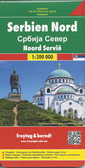
Serbia South Travel Map

Hover over image to zoom
)
Product Description
Freytag map of Serbia South scale 1:200,000, shows city maps, index with postal codes & distances in km.
Southern Serbia at 1:200,000 on a large, detailed, double-sided road map from Freytag & Berndt, with its index booklet also providing street plans of central Belgrade, Kragujevac and Niš. Coverage extends from Belgrade in the north-western corner of the map, with a generous overlap between the sides. Names of towns and villages are in both Cyrillic and Latin alphabet.
Topography is indicated by relief shading with spot heights, plus colouring for the forested areas; names of geographical features such as mountain ranges, etc, are mainly in the Latin alphabet only. The map shows the road network in much detail, including driving distances on many small local roads, steep gradients, roads with seasonal closures or restricted traffic, motorway services, etc. Railway lines are shown with stations and domestic airports are marked. Symbols indicate various places of interest, including campsites and youth hostels. The map has latitude and longitude lines at 10’ intervals. Multilingual map legend includes English.
The index, in a separate booklet attached to the cover, has street plans of central Belgrade, Kragujevac and Niš. Street names are in the Latin alphabet only.
The map also covers the northern part of Kosovo, including Pristina/Prishtina and Kosovska Mitrovica, with names of towns and villages in their Albanian and Serbian versions.