 Loading... Please wait...
Currency Displayed in
- Home
- Travel Maps
- Central America Travel Map
Categories
Related Products
-
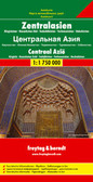 Central Asia Travel Map $9.95
 -

-

-
 South America Travel Map $9.95
 -


Central America Travel Map
 with a small overlap between the two sides. Relief is shown by elevation colouring and spot heights, with swamps, reefs and active volcanoes marked. Road network includes selected seasonal tracks, gives intermediate distances on main routes, and shows locations of border crossings and selected petrol stations. Railways, domestic airports and landing strips, and major ferry routes are marked, as well as the internal administrative boundaries with names of the provinces. National parks and nature reserves, beaches, archaeological sites and other places of interest are highlighted. Latitude and longitude lines are shown at intervals of 1°.
Each side has a a separate index of place names and is annotated with panels of useful information about the region. The map also includes enlargements of the Panama Canal corridor, the environs of San Jose, Isla del Coco, and Isla de San Andres.")
Hover over image to zoom
)
Product Description
ITMB double-sided, folded map of Central America on a scale of 1:1,100,000 including the countries of Nicaragua, Costa Rica, Panama, Belize, Guatemala, El Salvador and Honduras with tourist information, parks and points of interest, colour photos, general statistics of each country, and indexes. Map also has small insets of the Panama Canal area, Isla del Coco, Environs of San Jose and Isla de San Andres (Colombia). Great map to buy when travelling through Guatemala, Belize, Honduras, El Salvador, Nicaragua, Costa Rica and Panama.
Central America at 1:1,100,000 on a double-sided indexed map from ITMB with enlargements for the environs of San Jose and the Panama Canal area, information about each country’s size, highest peak, etc
The map divides the region north/south across Nicaragua (along the 12°latitude) with a small overlap between the two sides. Relief is shown by elevation colouring and spot heights, with swamps, reefs and active volcanoes marked. Road network includes selected seasonal tracks, gives intermediate distances on main routes, and shows locations of border crossings and selected petrol stations. Railways, domestic airports and landing strips, and major ferry routes are marked, as well as the internal administrative boundaries with names of the provinces. National parks and nature reserves, beaches, archaeological sites and other places of interest are highlighted. Latitude and longitude lines are shown at intervals of 1°.
Each side has a a separate index of place names and is annotated with panels of useful information about the region. The map also includes enlargements of the Panama Canal corridor, the environs of San Jose, Isla del Coco, and Isla de San Andres.