 Loading... Please wait...
Currency Displayed in
- Home
- Travel Maps
- Russia itmb Travel Map
Categories
Related Products
-
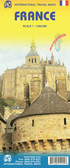 France itmb Travel Map $9.95
 -
 Mongolia itmb Travel Map $9.95
 -
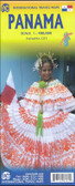 Panama itmb Travel Map $9.95
 -
 Turkey itmb Travel Map $9.95
 -
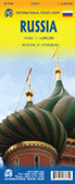

Russia itmb Travel Map

Hover over image to zoom
)
Product Description
We are pleased to re-issue an updated version of our map of that most enigmatic country, Russia. Whether one agrees with its current leader or policies, the country is fascinating. It is also the largest country on earth geographically. This edition, like previous ones, is double-sided with the western portion on one side and the eastern on the other. The relatively-densely populated area surrounding Moscow has been somewhat simplified, just to make room, and I fear that the font size will challenge some, but Russia's 125M population is spread over a vast area that humbles one. Like Japan, the population of Russia is rapidly shrinking through lack of immigration as its population ages. The map shows the major rail routes in the country, and now the new highway crossing Siberia. For most of us, Moscow and St. Petersburg are the most likely destinations for a visitor, and inset maps of both cities are included. That said, visitors would be well-advised to acquire ITMB city maps of Moscow and St. Petersburg before leaving home.
Map size: 27*39"
Russia at 1:6,000,000 on a double-sided, indexed map from ITMB, with street plans of central Moscow and St. Petersburg. The map divides the country east - west, with the European side extending well beyond the Urals to Krasnoyarsk and the Yenisei. Names of numerous mountain ranges are given and altitude colouring provides some indication of the topography, although rather faint colouring makes the Urals barely visible!
The map shows the country’s road and rail networks - it seems a pity that railway lines are not more prominently marked and easier to follow, since this map covers the whole of the Trans-Siberian route. The map also shows the country’s sub-divisions with names of the administrative regions. All place names are in the Latin alphabet only. The map, drawn using the Lambert Conformal Conic Projection, has latitude and longitude lines at 5º intervals. Each side has a separate index.
Street plans shows central Moscow and St. Petersburg, highlighting main sights.