Loading... Please wait...

Categories

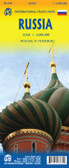
Russia and St Petersburg itmb Travel Map

Hover over image to zoom

  • Double-sided map from ITMB showing on one side a clear, indexed street plan of St. Petersburg and a road map of the city’s environs, plus on the reverse an indexed map of the western part of Russia at 1:3,200,000 with a street plan of central Moscow. 

On one side St. Petersburg is presented on an indexed street plan at 1:14,000 highlighting the city’s main traffic arteries and showing metro and railway stations with their names in both Latin and Cyrillic alphabets. Coverage extends, roughly, from top of the Aptekarsky Island and the Finland Station in the north to the Obvodny Canal and the Baltic Station in the south; and east/west from the Ladoga Station to the Pribaltiskaya Hotel on the Vasilievsky Island. Names of most streets and other locations on the map in both scripts; some smaller streets and hotels are mainly in the Latin alphabet only. Accompanying the plan is a map of the city’s metro network, plus a small road map showing the environs of St. Petersburg at 1:500.000 with highlighting main sights (presentation of place names varies). 

On the reverse Western Russia is shown on an indexed map at 1:3,200,000 showing its road and railway networks and highlighting places of interest. The map is orientated with the north-west at the top and has Murmansk in the north and Yekaterinburg in the south on its eastern edge. Topography is presented by altitude colouring with bands in feet; spot heights are given in metres. All places names are in the Latin alphabet. The map is accompanied by an inset showing at the same scale Kaliningrad Oblast, plus a street plan of central Moscow (place names mainly in the Latin alphabet).
ITMB
$13.95
SKU:
IT45678
Weight:
0.20 KGS

 Product Description

ITMB map of Russia & St Petersburg

Double-sided map from ITMB showing on one side a clear, indexed street plan of St. Petersburg and a road map of the city’s environs, plus on the reverse an indexed map of the western part of Russia at 1:3,200,000 with a street plan of central Moscow. 

On one side St. Petersburg is presented on an indexed street plan at 1:14,000 highlighting the city’s main traffic arteries and showing metro and railway stations with their names in both Latin and Cyrillic alphabets. Coverage extends, roughly, from top of the Aptekarsky Island and the Finland Station in the north to the Obvodny Canal and the Baltic Station in the south; and east/west from the Ladoga Station to the Pribaltiskaya Hotel on the Vasilievsky Island. Names of most streets and other locations on the map in both scripts; some smaller streets and hotels are mainly in the Latin alphabet only. Accompanying the plan is a map of the city’s metro network, plus a small road map showing the environs of St. Petersburg at 1:500.000 with highlighting main sights (presentation of place names varies). 

On the reverse Western Russia is shown on an indexed map at 1:3,200,000 showing its road and railway networks and highlighting places of interest. The map is orientated with the north-west at the top and has Murmansk in the north and Yekaterinburg in the south on its eastern edge. Topography is presented by altitude colouring with bands in feet; spot heights are given in metres. All places names are in the Latin alphabet. The map is accompanied by an inset showing at the same scale Kaliningrad Oblast, plus a street plan of central Moscow (place names mainly in the Latin alphabet).

 Find Similar Products by Category

You Recently Viewed...


newsletter

Copyright 2024 GoTrekkers. All Rights Reserved.
 Sitemap | Ecommerce Website Design by High Country Web Design.