Loading... Please wait...

Categories

India itmb Travel Map

Hover over image to zoom

  • India on an indexed, double-sided map, printed on waterproof and tear-resistant plastic paper, with a street plan of central New Delhi, enlargements for greater Mumbai and Kolkata and a separate index for each side of the map.

The map divides India north/south, with Assam and the north-eastern states shown as an inset, and presents the country’s road and rail networks. Local airports are marked. Internal administrative boundaries are shown with names of states given also in Hindi. Given the density of local roads shown on the map, perhaps not as many small town and villages are marked as one would expect.

Symbols highlight numerous places of interest, including the country’s historical and architectural treasures, temples and other religious sites, national parks and game reserves, etc. Larger cities are annotated with lists of their main sights. The map has latitude and longitude lines at intervals of 2º and a separate index of localities for each side. 

Also provided is a street plan of central New Delhi around the Connaught Place, annotated with hotels, restaurants, shops, banks, embassies, governmental offices, etc. Two more insets show the areas of greater Mumbai and Kolkata (Calcutta) with main roads and rail connections.
ITMB
$12.95
SKU:
IT293631
Weight:
0.20 KGS

 Product Description

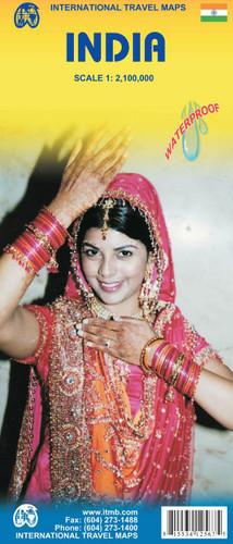
This started as a ‘tidying up’ update, but so much new information has been added that it has become a full update. We have retained the same cover photo of our lovely god-daughter in her traditional wedding dress, and there is no change in price or format. The front cover also now notes that the Andaman and Nicobar Islands are included as part of the map (in insets). As well, insets for Delhi, Mumbai, and Kolkata have been updated. India, as a country, is modernizing quite quickly, and tourism is growing in leaps and bounds as a result. As is normal in developing countries, there is a great difference between the major urban areas and touristic sites and much of the rural parts of India. Facilities for visitors are vastly improved since my last visit, the country is generally safe for travellers, and the attractions are nothing short of superb. We have noticed a tremendous increase in demand for maps of India over the past three years. The map has been printed on durable ITM plastic paper for durability in India’s hot, tropical environment. 
Map size: 27"X39"

India on an indexed, double-sided map, printed on waterproof and tear-resistant plastic paper, with a street plan of central New Delhi, enlargements for greater Mumbai and Kolkata and a separate index for each side of the map.

The map divides India north/south, with Assam and the north-eastern states shown as an inset, and presents the country’s road and rail networks. Local airports are marked. Internal administrative boundaries are shown with names of states given also in Hindi. Given the density of local roads shown on the map, perhaps not as many small town and villages are marked as one would expect.

Symbols highlight numerous places of interest, including the country’s historical and architectural treasures, temples and other religious sites, national parks and game reserves, etc. Larger cities are annotated with lists of their main sights. The map has latitude and longitude lines at intervals of 2º and a separate index of localities for each side. 

Also provided is a street plan of central New Delhi around the Connaught Place, annotated with hotels, restaurants, shops, banks, embassies, governmental offices, etc. Two more insets show the areas of greater Mumbai and Kolkata (Calcutta) with main roads and rail connections. 

 Find Similar Products by Category

You Recently Viewed...


newsletter

Copyright 2024 GoTrekkers. All Rights Reserved.
 Sitemap | Ecommerce Website Design by High Country Web Design.