 Loading... Please wait...
Currency Displayed in
- Home
- Travel Maps
- Georgia Republic and Armenia Travel Map
Categories
Georgia Republic and Armenia Travel Map
Product Description
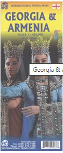
Armenia and Georgia at 1:430,000 on an indexed map from ITMB. Each side of the map covers the whole of one of these two countries, presented with a street plan of its capital. Diverse ethnography of the region is indicated on an inset.
Topography is shown by altitude colouring in feet, with heights of peaks given in metres (and not in feet as indicated in the map legend). Mountain passes are annotated with months when passable. Swamp areas are marked and national parks or protected areas highlighted. The map shows the region’s road and rail networks, including selected seasonal tracks, and indicates local airports. Symbols highlight various places of interest: historical sites, beaches, winter sport areas, etc. All place names are in the Latin alphabet only. Latitude and longitude lines are drawn at 1° intervals. Each country has a separate index.
Street plans of central Yerevan and Tbilisi name main streets and highlight various places of interest including selected foreign embassies. Also provided is an inset showing the distribution of various ethnographic groups.


