Loading... Please wait...

Categories

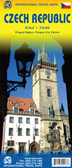
Czech and Slovak Republic Travel Map

Hover over image to zoom

  • Detailed road map of Czech and Slovak Republics at 1:400,000 from Freytag & Berndt with index and city centre street enlargements of Prague and Bratislava. Clearly shows the national road network and selected provincial and local roads, with each class of road clearly indicated and road numbers shown. Intermediate driving distances between locations are shown in kilometres alongside the road, motorway filling stations are shown and motorway junctions are indicated. 

Topography is shown primarily through spot heights, though there is very subtle relief shading and colour shading is used to indicate land types such as forests or marshland. International and provincial boundaries are clearly marked, as are National Parks, nature reserves and restricted military areas. 

Symbols indicate various sights & locations of tourist interest, such as churches, leisure & sports destinations, panoramas & viewing points, monuments and historic sites. Some hotels and campsites are marked. Railway lines, airports, ports and marinas are also shown. 

A grid divides the map at 30’ increments, and is also grid-referenced for the accompanying index booklet. 

*Multilingual map legend includes English.*
Freytag
$11.95
SKU:
AK1101
Weight:
0.20 KGS

 Product Description

Freytag double-sided, folded road map of the Czech Slovak Republic at 1:400,000 with city maps for Bratislava and Praha, tourist information, distances in km & index with postal codes. Great quality map to buy for your travels through the Czech Slovak Republic.

Detailed road map of Czech and Slovak Republics at 1:400,000 from Freytag & Berndt with index and city centre street enlargements of Prague and Bratislava. Clearly shows the national road network and selected provincial and local roads, with each class of road clearly indicated and road numbers shown. Intermediate driving distances between locations are shown in kilometres alongside the road, motorway filling stations are shown and motorway junctions are indicated. 

Topography is shown primarily through spot heights, though there is very subtle relief shading and colour shading is used to indicate land types such as forests or marshland. International and provincial boundaries are clearly marked, as are National Parks, nature reserves and restricted military areas. 

Symbols indicate various sights & locations of tourist interest, such as churches, leisure & sports destinations, panoramas & viewing points, monuments and historic sites. Some hotels and campsites are marked. Railway lines, airports, ports and marinas are also shown. 

A grid divides the map at 30’ increments, and is also grid-referenced for the accompanying index booklet. 

*Multilingual map legend includes English.*

 Find Similar Products by Category

You Recently Viewed...


newsletter

Copyright 2024 GoTrekkers. All Rights Reserved.
 Sitemap | Ecommerce Website Design by High Country Web Design.