 Loading... Please wait...
Currency Displayed in
- Home
- Travel Maps
- Czech Republic itmb Travel Map
Categories
Related Products
-
-
-
 France itmb Travel Map $9.95
 -
 Mongolia itmb Travel Map $9.95
 -
 Turkey itmb Travel Map $9.95

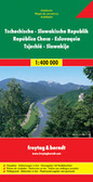
Czech Republic itmb Travel Map

Hover over image to zoom
)
Product Description
We have spent a lot of time and effort converting our Czech artwork into a true travel map. I had great fun doing the researching and, while Jiri Navratil could no doubt come up with dozens of other sites worthy of note, this map is significantly stronger in showing what there is to see in this historic part of Europe. Prague tends to get the lion's share of attention from visitors, but Kutna Hora is a UNESCO World Heritage Site, as is Cesky Krumlov, where IMTA held an amazing conference in the dead of winter one year. The Republic is easy to reach from most parts of Europe and is arguably the most travel-visited country in Europe. Our map still shows roads classified by quality and distances between communities, but the artwork has been modernized significantly and a lot of emphasis has been placed on travel spots outside of Prague, which also graces the map as an inset.
Czech Republic at 1:370,000 on a double-sided, indexed map from ITMB presenting the country’s road network on a base with altitude colouring, plus an enlargement showing road access to central Prague and a street plan of the city.
The map divides the country east/west with a small overlap between the sides. Driving distances are marked on main roads. Railway lines are included and local airports are marked. Symbols indicate various places of interest, including campsites, UNESCO World Heritage sites, etc. Latitude and longitude lines are drawn at 1° intervals. Each side has a separate index.
Also provided is a map showing main roads and railway/metro connections across Prague, plus a street plan of the city centre, both annotated with places of interest.