Loading... Please wait...

Categories

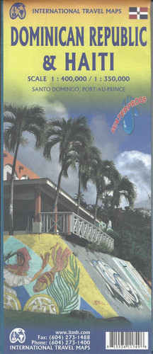
Dominican Republic Haiti Travel Map

Hover over image to zoom

  • Waterproof and tear-resistant map, with each country on one side accompanied by a small plan of its capital. Dominican Republic is shown at 1:400,000 with a plan of Santo Domingo, and on the reverse side Haiti at 1:350,000 with a plan of Port-au-Prince. In each country local administrative boundaries are marked, with names of the provinces. Topography is indicated by altitude colouring (in feet), spot heights and names of hill and mountain ranges. Road network includes unsurfaced tracks and marks border crossings between the two countries. Railways, ferry routes and local airfields are also shown. 

Extensive range of symbols marks selected hotels, beaches, sites for various outdoor activities (fishing, diving golf, etc.) viewpoints, places of interest, etc. Latitude and longitude lines are drawn at intervals of 30’. Both countries have separate indexes of place names. 

An enlargement of Santo Domingo is included.
ITMB
$9.95
SKU:
IT0020
Weight:
0.20 KGS

 Product Description

ITMB double-sided, folded topographical map of Dominican Republic (1:400,000) and Haiti (1:350,000) on waterproof paper with indexes and points of interest. Map also has inset of Santo Domingo (6"x4"), Port-Au-Prince (9"x6") and Ile de la Tortue (6"x3"). Great road map to buy for travelling in the Dominican Republic and Haiti.

Waterproof and tear-resistant map, with each country on one side accompanied by a small plan of its capital. Dominican Republic is shown at 1:400,000 with a plan of Santo Domingo, and on the reverse side Haiti at 1:350,000 with a plan of Port-au-Prince. In each country local administrative boundaries are marked, with names of the provinces. Topography is indicated by altitude colouring (in feet), spot heights and names of hill and mountain ranges. Road network includes unsurfaced tracks and marks border crossings between the two countries. Railways, ferry routes and local airfields are also shown. 

Extensive range of symbols marks selected hotels, beaches, sites for various outdoor activities (fishing, diving golf, etc.) viewpoints, places of interest, etc. Latitude and longitude lines are drawn at intervals of 30’. Both countries have separate indexes of place names. 

An enlargement of Santo Domingo is included.

 Find Similar Products by Category

You Recently Viewed...


newsletter

Copyright 2025 GoTrekkers. All Rights Reserved.
 Sitemap | Ecommerce Website Design by High Country Web Design.