 Loading... Please wait...
Currency Displayed in
- Home
- Maps By Sport
- Hiking Maps
- Condor Circuit Chile Trekking Map
Categories
Related Products


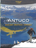
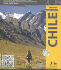

Condor Circuit Chile Trekking Map

Hover over image to zoom

)
Product Description
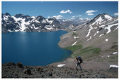
Completely revised map of the naturally beautiful and pristine territory between the natural preserves of Altos de Lircay and Siete Tazas, including Descabezado Grande volcano and the Condor Circuit hiking route. With level curves each 50 m, hiking routes, thermal baths, campsites and lodgings, landscape pictures and drawings of the local fauna. GPS compatible. QR codes take you directly to the tour descriptions in the Trekkingchile app.
Detail maps 1:25,000 of the Radal Siete Tazas and Altos de Lircay nature preserves.
Trekkingchile, 5th edition 2016
Trekking Map, Central Chile, scale 1:50,000 / 1:25.000
Printed on Stone Paper, water & tear resistant
English – German - Spanish.