 Loading... Please wait...
Currency Displayed in
- Home
- Maps By Sport
- Hiking Maps
- Antuco Chile Trekking Map
Categories
Related Products
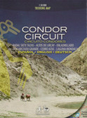


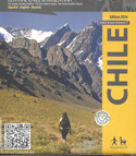

Antuco Chile Trekking Map

Hover over image to zoom
)
Product Description
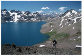
The first trekking map of the National Park Laguna del Laja in the Central Chilean Andes, with Antuco volcano (2979 m) and Sierra Velluda (3585 m). With altitude levels each 50 m, hiking and climbing routes (distances in km), lodgings, campings, etc. Landscape pictures and drawings of the local fauna.
Trekkingchile
Trekking Map, Central Chile, scale 1:30,000
English – German - Spanish.
1st edition, 2011
?