 Loading... Please wait...
Currency Displayed in
- Home
- Travel Maps
- Thailand Travel Map
Categories
Related Products
-
-
 Victoria Map Travel Map $9.95
 -

-
-
 Bolivia Map Travel Map $9.95

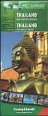
Thailand Travel Map

Hover over image to zoom
)
Product Description
Freytag double-sided, folded road map of Thailand at 1:1,000,000 with tourist information, national parks & index. Best quality map of its kind to buy for travelling through Thailand.
Thailand at 1:900,000 on a large, double-sided, indexed road map from Freytag & Berndt, with clear presentation of the country’s road network, its topography, various places of interest and its administrative divisions.
The map divides the country north/south, with a good overlap between the sides. Colouring and relief shading with spot heights show the country’s topography. National parks and other protected areas are clearly highlighted. Road network includes selected unpaved roads and local tracks, with driving distances indicated on main routes. The map also shows railway lines, ferry connections and local airports, as well as the country’s internal administrative boundaries with names of the provinces.
Various places of interest at highlighted by symbols with their names given in English, e.g. ancient or historic city, floating market, historic park, etc. The map has latitude and longitude lines at intervals of 1º and an extensive index. Map legend includes English.