 Loading... Please wait...
Currency Displayed in
- Home
- Travel Maps
- Thailand Pocket Travel Map
Categories
Related Products
-
-
 Thailand Travel Map $9.95
 -
 Victoria Map Travel Map $9.95
 -
-
 Bolivia Map Travel Map $9.95

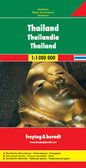
Thailand Pocket Travel Map

Hover over image to zoom
)
Product Description
Freytag compact pocket map of Thailand on waterproof material in a plastic sleeve at scale 1:1.200,000. Shows roads, city center map, travel information, sights & many pictures.
Thailand at 1:1,200,000 on light, waterproof at tear-resistant map published by Freytag & Berndt in their “World Compact” series which combines a country map with street plans and extensive tourist information: descriptions of places of interest, a fact-box, etc.
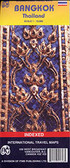
The map is double-sided, with a small overlap between the sides. Topography is shown by relief shading with spot heights, National parks and other protected areas are highlighted. Road network includes local roads and selected cart tracks, and gives distances on main routes. Railway lines are included and local airports are marked. Also shown are internal administrative boundaries with names of the provinces. Icons indicate various places of tourist interest such as campsites, UNESCO World Heritage sites, other historical and archaeological sites, hot springs, beaches, etc. The map is indexed and has latitude and longitude lines drawn at 1° intervals.
A special feature of Freytag & Berndt’s World Compact series are additional street plans and information panels, illustrated with colour photos, with descriptions of main tourist destinations, important natural features, facts and figures about the country, a phrase book, tourist tips, etc. The map of Thailand includes a street plan of central Bangkok.
Map legend and all the text in the information panels is bilingual English – German.