 Loading... Please wait...
Currency Displayed in
- Home
- Maps By Sport
- Canoe Maps Canada
- Southern Indian Lake to Hudson Bay Coast via South Seal River and Seal River (8 Maps)
Categories
Related Products
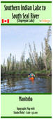

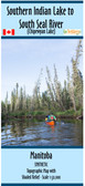
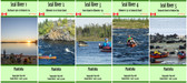
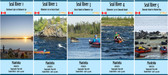
Southern Indian Lake to Hudson Bay Coast via South Seal River and Seal River (8 Maps)
")
Hover over image to zoom
, $169.95 (https://gotrekkers.com/southern-indian-lake-to-hudson-bay-coast-via-south-seal-river-and-seal-river-8-maps/))
Product Description
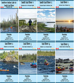
Topographic Map Set from the north end of Southern Indian Lake to the Hudson Bay Coast via South Seal River and Seal River, Manitoba
Scale of 1:50,000 with shaded relief. Contours are in 10m and 50m intervals.
Shows Campsites, rapids information, portages, and helpful advice when using the map.
Includes:
Southern Indian Lake to South Seal River
South Seal River 1 - Chipewyan Lake to Porcupine Rapids
South Seal River 2 - Porcupine Rapids to Shethanei Lake
Seal River 1 - Shethanei Lake to Kilometer 60
Seal River 2 - Kilometer 60 to Great Island
Seal River 3 - Great Island to Kilometer 170
Seal River 4 - Kilometer 170 to Tamarak Island
Seal River 5 - Tamarak Island to Hudson Bay Coast
Maps are printed on paper and come folded in protective plastic sleeves