 Loading... Please wait...
Currency Displayed in
- Home
- Travel Maps
- South Korea Seoul Travel Map
Categories
Related Products
-
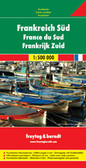 France South Travel Map $9.95
 -
 Serbia South Travel Map $9.95
 -
 South America Travel Map $9.95
 -

-
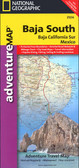 Baja South Travel Map $9.95

South Korea Seoul Travel Map
 to present the topography. National parks and other protected area are highlighted. The map shows the country’s road and rail networks, indicating also local airports and coastal ferry routes. Symbols highlight various places of interest, including historical sights, temples, numerous beaches, bird sanctuaries, etc. Jeju-Do Island is shown on an enlargement at 1:275,000. Latitude and longitude lines are drawn at intervals of 30’.
On the reverse is a street plan of central Seoul at 15,000, with names of districts many apartment complexes. Metro or rapid transit routes and their stations are clearly marked, with separate diagrams provided for the whole networks and an index of metro stations. The map indicates principal traffic routes across the city and highlights numerous places of interest including cultural institutions, historical sights, shopping centres, selected accommodation, etc. The index list names of main streets")
Hover over image to zoom
)
Product Description
Folded map of Seoul & South Korea at a scale of 1;15,000 & 1;550,000
South Korea on a double-sided map showing on one side a road map of the country at 1:550,000 and on the reverse a street plan of Seoul at 1:15,000. Both are indexed and highlight main sights, plus various facilities in the capital.
The country map has altitude colouring and spot heights (in feet) to present the topography. National parks and other protected area are highlighted. The map shows the country’s road and rail networks, indicating also local airports and coastal ferry routes. Symbols highlight various places of interest, including historical sights, temples, numerous beaches, bird sanctuaries, etc. Jeju-Do Island is shown on an enlargement at 1:275,000. Latitude and longitude lines are drawn at intervals of 30’.
On the reverse is a street plan of central Seoul at 15,000, with names of districts many apartment complexes. Metro or rapid transit routes and their stations are clearly marked, with separate diagrams provided for the whole networks and an index of metro stations. The map indicates principal traffic routes across the city and highlights numerous places of interest including cultural institutions, historical sights, shopping centres, selected accommodation, etc. The index list names of main streets