 Loading... Please wait...
Currency Displayed in
- Home
- Travel Maps
- South East Asia itmb Travel Map
Categories
Related Products
-
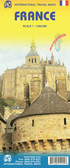 France itmb Travel Map $9.95
 -
-
-
-

South East Asia itmb Travel Map

Hover over image to zoom
)
Product Description
6th Edition The part of the world from southern China, through the Indo-Chinese peninsula, and sweeping through the Indonesian archipelago to the hundreds of islands comprising the Philippines, is a fascinating part of the world to map. Countless cultures interact in this vast region – the mountain people along the Vietnamese/Laotian border, the fisherman of coastal regions and islands, the lovely and gentle Balinese, and the business-like Javanese. This is an extremely important part of the world – touristically attractive, economically thriving, and scenically unbeatable. This latest edition will be useful for anyone visiting the region. It is detailed, printed double-sided. This map has proven to be a better seller than expected, necessitating a review. We keep the same cover, same ISBN, same price.
Map size: 27*39” per side
South-East Asia, including the whole of Indonesia and the Philippines, at 1:4,000,000 on an indexed, double-sided map from ITMB with street plans of central Manila and Jakarta highlighting various places of interest.
On one side are the mainland countries and western Indonesia, extending along the northern edge of the map from Dhaka and Chittagong to Guangzhou and Hong Kong. Northern part of Burma is shown as an inset. On the reverse are southern Taiwan and the Philippines. Indonesia is divided between the two sides of the map along the line across the middle of Borneo and Bali.
Altitude colouring shows the topography, with graphics for marshes, mangrove coast, coral reefs, and desert areas. The map shows the region’s main road and rail networks and highlights various places of interest, including national parks and cultural landmarks, some annotated with brief notes. Latitude and longitude are shown as margin ticks at 1° intervals. Each side of the map has a separate index.
Also included are street plans of central Manila and Jakarta highlighting various places of interest, including selected hotels, foreign embassies, cultural and historical sites, etc.