Loading... Please wait...

Categories

South Africa Lesotho Swaziland itmb Travel Map

Hover over image to zoom

  • Double-sided map of South Africa printed on waterproof and tear-resistant synthetic paper, with plans of Cape Town, Johannesburg and Pretoria. The map divides the country east/west with a small overlap between the two sides. Elevation tinting in feet shows the general relief. Mountain passes are marked, but there are no spot heights.

Road network includes selected local tracks, gives driving distances on major and secondary roads and indicates border crossings. Railways, major ferry connections and local airports are also shown. National parks and protected areas are marked and symbols highlight various places of interest, campsites or huts, rest houses and other tourist accommodation, beaches and diving sites, etc. Presentation of Lesotho and Swaziland is the same as for South Africa.

Latitude and longitude lines are marked at 1 degree intervals. The map is indexed and includes street plans of central Cape Town, Johannesburg, and Pretoria, highlighting selected accommodation, places of interest and various facilities.
ITMB
$12.95
SKU:
IT414063
Weight:
0.20 KGS

 Product Description

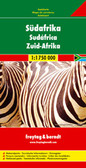
South Africa Travel Reference Map 4th Ed. 2015 1:1,350,000 on plastic paper ISBN 9781553414063 UPC 815534140630. $12,95CAD/USD E9.50 8.95GBP - This is a modest updating and re-working of artwork to make it easier to read. The cover remains the same, with the regal lion gracing the cover, and the map remains focused on providing clear and easy-to-understand road and tourism information. South Africa remains one of the most enjoyable countries in Africa for visitors. The country's necessary infrastructure is in good shape, with affordable hotels and good restaurants, as well as the continent's best game preserves and some magnificent desert and mountain scenery. UNESCO World Heritage sites have been noted and attention has been paid to noting attractions for visitors. As always, we welcome information that would make this map even better. 

Map size: 27*39" 

Double-sided map of South Africa printed on waterproof and tear-resistant synthetic paper, with plans of Cape Town, Johannesburg and Pretoria. The map divides the country east/west with a small overlap between the two sides. Elevation tinting in feet shows the general relief. Mountain passes are marked, but there are no spot heights.

Road network includes selected local tracks, gives driving distances on major and secondary roads and indicates border crossings. Railways, major ferry connections and local airports are also shown. National parks and protected areas are marked and symbols highlight various places of interest, campsites or huts, rest houses and other tourist accommodation, beaches and diving sites, etc. Presentation of Lesotho and Swaziland is the same as for South Africa.

Latitude and longitude lines are marked at 1 degree intervals. The map is indexed and includes street plans of central Cape Town, Johannesburg, and Pretoria, highlighting selected accommodation, places of interest and various facilities.

 Find Similar Products by Category

You Recently Viewed...


newsletter

Copyright 2024 GoTrekkers. All Rights Reserved.
 Sitemap | Ecommerce Website Design by High Country Web Design.