 Loading... Please wait...
Currency Displayed in
- Home
- Books
- Ski Tour Books Canada
- Rogers Pass Back Country Skiing book South
Categories
Related Products

Rogers Pass Back Country Skiing book South

Hover over image to zoom
)
Product Description
Crafted with the highest-quality materials by one of North America’s top printers.
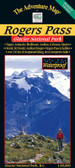
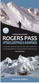
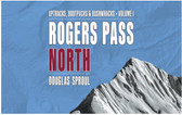
This two-part volume, GeoBackcountry Rogers Pass: Uptracks, Bootpacks & Bushwhacks, is the third edition of author and skier Douglas Sproul’s companion guidebooks to backcountry skiing routes in Rogers Pass, complete with maps, illustrations, and full-colour photography. Located in British Columbia’s Selkirk Mountains within Glacier National Park, two distinct areas are covered by each book. North is Volume 1 and south is Volume 2, as geographically divided by the Trans-Canada Highway.
Sproul’s inimitable guide is packed with practical insights gained from his hard-earned knowledge exploring the backcountry with a keen eye and a pair of skis. Each volume is laid out in logical sections, providing readers with invaluable information on everything from terrain, skill level, parking, avalanche safety, park permits, and more.
Tech specs
-
Developed in Revelstoke, BC
-
Printed in Canada
-
3rd Edition
-
Dimensions: 8.5” x 5.5” (landscape)
-
Pages: 264
-
Release date:
-
ISBN: 978-0-9937695-7-3
-
Regionality: British Columbia
-
Language: English
-
Ideal for: Backcountry skiing | Ski mountaineering
Featuring
-
Wire-O lay-flat binding
-
8.5” x 5.5” landscape format
-
Full colour
-
273 routes (both books combined)
-
New terrain
-
Photo specific sections
-
Full page, high-quality, illustrated photos
-
Updated route grading
-
New custom maps
-
New and improved route descriptions
-
Local knowledge
-
Ski traverses
-
Backcountry huts
-
GPS coordinates and location info
-
Parks Canada trails
-
Parks Canada Designated Access Routes
Mountain photography
Mountain photography is mostly landscape photography which is naturally, best presented in a landscape format. Terrain photography in the new books is a useful blend of aerial and land-based images. This results in a better understanding of the terrain as well as a real-life view as viewed by the skier on the ground.
-
Full-page (8.5” x 5.5”) high-resolution photos
-
17” x 5.5” double-page spreads
Mindfully researched and carefully selected photos from various angles:
-
Aerial photos for overview
-
Mid-level ground and aerial photos for detailed terrain view
-
Low-level ground photos for the approach view