 Loading... Please wait...
Currency Displayed in
- Home
- Maps By Sport
- Hiking Maps
- Punta Arenas Cabo Froward Trekking Map
Categories
Related Products
-
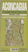 Aconcagua Trekking map $9.95
 -
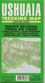 Ushuaia Trekking Map $9.95
 -
 Pucon Trekking Map $9.95
 -
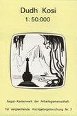 Dudh Kosi Trekking Map $9.95
 -
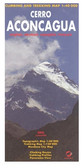 Aconcagua Trekking map cmc $14.95

Punta Arenas Cabo Froward Trekking Map

Hover over image to zoom
)
Product Description
Punta Arenas Península de Brunswick, Estrecho de Magallanes, Cabo Froward January 2015 2000 copies The most southerly point on the continent, Cabo Froward orCape Froward is 90km south of Punta Arenas and accessible by a five-day round trip hike along wind-whipped Magallanes Straight. Printed on durable StonePaper, waterproof, tear-resistant and tough — capable of withstanding the rigors of trekking. Flat and folded: 73 x 50 / 25 x 15 cms, 140 micras. 10+ copies – $5.00 US + applicable tax and shipping, Sells for $8.00 -13.00 US. Side 1: 1:85.000 Trekking route Cabo Froward, topographic with contour lines and relief. Southern part of the Brunswick Peninsula, from Fort Bulnes to Cabo Froward, southern most point in the South American Continent. Shows the Cabo Froward trekking route, with GPS points, Coordinates in UTM and Lat/Long. Side 2: 1:285.000 The entire Brunswick Peninsula, Punta Arenas down to Cabo Froward showing the Magallanes and Laguna Parrillar Reserves as well as Fort Bulnes. Fiordo Silva Palma, Magallanes Straight, Coordinates in UTM and Lat/Long.