Loading... Please wait...

Categories

Philippines itmb Travel Map

Hover over image to zoom

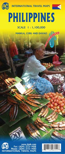
  • Philippines at 1: 1,100,000 from ITMB on a double-sided, indexed road map including street plans of central Davao city and Cebu city and Manila city centre. 

Road networks include motorways, secondary and minor roads and tracks, with intermediate distances in kilometres. Symbols clearly indicate international and domestic airports, railways and ferry routes. 

Topography is represented by altitude colouring and spot heights; graphics indicate rivers, lakes, coral reefs etc. 

Symbols mark locations of various places of interest including museums, churches, caves, national parks, beaches, dive sites, ports, etc. International, regional and provincial boundaries are clearly marked. 

The map is indexed and annotated with historical and tourist information of places of interest, illustrated with colour pictures and includes a small inset showing major national air routes. 

It includes street plans of central Davao city and Cebu city and Manila city centre at approximately 1:12,000. 

Latitude and longitude lines are drawn at intervals of 2°.
ITMB
$9.95
SKU:
IT296141
Weight:
0.20 KGS

 Product Description

This latest edition of the many islands comprising the Philippines comes are a good time. Tourism is booming and, provided one avoids the southernmost islands, is a pleasurable experience. The map has been printed on waterproof paper and bears a new ISBN, although this is more to bring the map into our new prefix than because of massive changes. The side showing the north half of the country includes a very large and detailed inset map of Manila and the south half side has insets of Cebu and Davao City. 

Map size: 27*39"

Philippines at 1: 1,100,000 from ITMB on a double-sided, indexed road map including street plans of central Davao city and Cebu city and Manila city centre. 

Road networks include motorways, secondary and minor roads and tracks, with intermediate distances in kilometres. Symbols clearly indicate international and domestic airports, railways and ferry routes. 

Topography is represented by altitude colouring and spot heights; graphics indicate rivers, lakes, coral reefs etc. 

Symbols mark locations of various places of interest including museums, churches, caves, national parks, beaches, dive sites, ports, etc. International, regional and provincial boundaries are clearly marked. 

The map is indexed and annotated with historical and tourist information of places of interest, illustrated with colour pictures and includes a small inset showing major national air routes. 

It includes street plans of central Davao city and Cebu city and Manila city centre at approximately 1:12,000. 

Latitude and longitude lines are drawn at intervals of 2°.

 Find Similar Products by Category

You Recently Viewed...


newsletter

Copyright 2024 GoTrekkers. All Rights Reserved.
 Sitemap | Ecommerce Website Design by High Country Web Design.