 Loading... Please wait...
Currency Displayed in
- Home
- Travel Maps
- Peru Travel Map
Categories
Related Products
-
 Victoria Map Travel Map $9.95
 -

-
 Bolivia Map Travel Map $9.95
 -
 Peru itmb Travel Map $9.95
 -


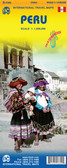
Peru Travel Map

Hover over image to zoom
)
Product Description
Freytag double-sided, folded road map of Peru on a scale of 1:1,200,000 with tourist information, distances in km, index and national parks. Great map to buy if travelling to Peru, South America.
The map divides the country north/south; the region south of Arequipa is on an inset. Vivid relief shading presents the topography, with spot heights and names of various mountain ranges, peaks, etc, plus graphics for swamps, salt marshes, deserts, etc. National park and protected areas are highlighted.
Road network includes selected local roads and cart tracks, shows driving distances on main and many secondary routes, and indicates locations with filling stations. The map also highlights the tourist route along the country’s coast. Railway lines are included and local airports are marked, as well as the country’s internal provincial borders and oil pipelines.
Icons prominently indicate locations of numerous places of interest. Latitude and longitude are marked at 1º intervals. The index is in a separate booklet attached to the map cover. Multilingual map legend includes English.