 Loading... Please wait...
Currency Displayed in
- Home
- Travel Maps
- Morocco Travel Map
Categories
Related Products
-
 Victoria Map Travel Map $9.95
 -

-

-
 Bolivia Map Travel Map $9.95
 -
 Morocco itmb Travel Map $9.95

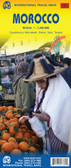
Morocco Travel Map

Hover over image to zoom
)
Product Description
Freytag folded road map of Morocco at 1:900,000 and at 1:2,250,000 with city maps, distances in km & index. Map insets are for Casablanca (9"x6"), Fez (9"x6"), Marrakech (9"x6"), Rabat (2"x6") and Tanger (4"x6"). Great quality map to buy for travelling in Morocco, Africa.
Morocco at 1:800,000 with the Western Sahara at 1:2,000,000 on a large map from Freytag and Berndt with an index booklet attached to the cover providing street plans of central Casablanca, Fès, Marrakesh, Rabat/Salé and Tangier.
Relief shading with spot heights, graphics for sandy or rocky deserts, swamps, seasonal streams, etc. show the topography. Road network includes desert tracks and indicates distances on main routes. Railway lines are included and local airports are marked. Places of interest including the country’s UNESCO World Heritage sites are highlighted.
All place names are shown in the Latin alphabet only, except major cities which are also given their Arabic names. The map has latitude and longitude lines at intervals of 1°. Multilingual map legend includes English.
The index, in a separate booklet attached to the map cover shows most localities with their post codes and includes plans of central Casablanca, Fès, Marrakesh, Rabat/Salé and Tangier, naming main streets and indicating principal traffic arteries.