 Loading... Please wait...
Currency Displayed in
- Home
- Travel Maps
- Kenya Travel Map
Categories
Related Products
-
-
 Victoria Map Travel Map $9.95
 -

-
-
 Bolivia Map Travel Map $9.95

Kenya Travel Map

Hover over image to zoom
)
Product Description
Freytag folded road map of Kenya at 1:500,000 and Kenya Coast at 1:700,000 (13"x7") with city-centre maps, national park and index. Map has Nairobi (9"x7"), Mombasa (4"x6"), and Masai Mara National Reserve (8"x6") insets. Best quality map of its kind to buy for travelling in Kenya, Africa.
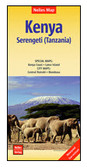
Kenya on an indexed map from Freytag & Berndt showing the whole country on one side at a good scale of 1:1,000,000 but with its south-eastern region as an inset. Cartography is an enlargement of the publishers’ map of East Africa so has greater clarity and larger size print, and also includes additional tourist information.
The south-eastern corner with the coast around Mombasa and Malindi is shown on an inset which also covers the East and West parts of the Tsavo National Park, plus are border region of Tanzania with Kilimanjaro. Topography is shown by relief shading, spot heights and names of various mountain ranges, valleys, etc, plus colouring and/or graphics for forested areas, deserts, marshland and swaps, salt pans, etc. In the arid areas numerous wells are marked. National parks and other protected areas are prominently highlighted.
The map shows the country’s road and rail networks, including selected minor local roads and tracks. Driving distances are shown on main and many secondary routes and the map also indicates locations with filling stations. Domestic airports are marked and a range of icons prominently highlight numerous places of interest. Latitude and longitude lines are drawn at 1º intervals. The index is next to the map. Map legend includes English.