 Loading... Please wait...
Currency Displayed in
- Home
- Travel Maps
- Jordan Travel Map
Categories
Related Products
-
 Victoria Map Travel Map $9.95
 -

-

-
 Bolivia Map Travel Map $9.95
 -
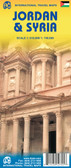

Jordan Travel Map

Hover over image to zoom
)
Product Description
Jordan Travel Map
Jordan at 1:700,000 on a road map from Freytag & Berndt, boldly highlighting main places of interest. The map includes a large street plan of central Amman and has its index conveniently placed next to it. All place names, in Latin alphabet only, are larger print than used on other maps.
Relief shading with spot heights, graphics for sandy or rocky deserts, swamps, seasonal streams, etc. show the topography. Road network includes desert tracks and indicates distances on main routes. Railway lines are included and local airports are marked. Places of interest including archaeological sites and nature reserves are prominently highlighted. The map has latitude and longitude lines at intervals of 1°. Multilingual map legend includes English.
Please note: in the adjoining areas, the presentation of the international boundaries of the West Bank and particularly in the Golan Heights may be confusing to those not familiar with the current political situation in the region. Place names within the West Bank are transliterated from their Arabic versions.