 Loading... Please wait...
Currency Displayed in
- Home
- Travel Maps
- Istria Pula Travel Map
Categories
Related Products
-
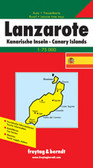 Lanzarotte Travel Map $9.95
 -
 Victoria Map Travel Map $9.95
 -

-

-
 Bolivia Map Travel Map $9.95

Istria Pula Travel Map

Hover over image to zoom
)
Product Description
Freytag folded road and leisure map of Istria & Pula at 1:100,000 with attached booklet describing the top ten sights, city maps for Umago, Porec, Rovigno, Pula and Opatija (all 5"x5"), and index with postal codes. Great quality map to buy for your travels through Istria-Pula.
Istria "Top 10 Tips" double-sided map at 1:100,000 from Freytag & Berndt highlighting recommended cycling trails and picturesque locations, with plans of central Pula, Rovinj, Opatija, Umag and Porec, plus descriptions of the region’s top 10 sights. Coverage extends north to include Trieste and the south-western corner of Slovenia, plus most of the nearby island of Cres.
The map is double-sided with a good overlap between the sides. Topography is shown by relief shading with spot heights, with colouring for woodlands. Driving distances are marked on main and selected secondary roads. Scenic roads as well as recommended cycling routes and mountain bike trails are highlighted. Railways lines and ferry connections to the islands are marked. The map also highlights picturesque locations, with the region’s top 10 sights prominently marked and cross-referenced to descriptions in the accompanying booklet. Symbols indicate other places of interest and facilities, including campsites and youth hostels, marinas, etc. Latitude and longitude lines are drawn at intervals of 5’. The index, listing locations with their postcodes, is in the accompanying booklet
Surrounding the map are street plans of central Pula, Rovinj, Opatija, Umag and Porec, and the booklet also includes brief descriptions of several recommended cycling routes. Map legend, conveniently shown on both sides of the map, and the descriptions include English.