Loading... Please wait...

Categories

Iceland itmb Travel Map

Hover over image to zoom

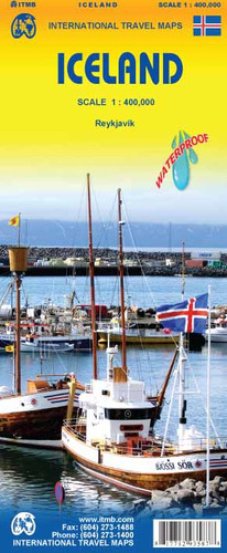
  • Iceland at 1:425,000 on a double-sided indexed road map from ITMB, printed on light waterproof and tear-resistant plastic paper, with a large street plan of central Reykjavik. The map divides the country east/west with a very small overlap between the sides. Altitude colouring with spot heights and plenty of names of various geographical features shows Iceland’s topography. Glaciers and national parks or other protected areas are clearly marked. 

Road network distinguishes between paved, unpaved and gravel road. Locations of petrol stations are marked and intermediate distances are given on main routes and selected secondary or local roads. Symbols highlight local airfields, tourist lodges and emergency huts, campsites, hot springs and geysers, golf courses, fishing and skiing areas, viewpoints, etc. The map is indexed and has a latitude and longitude grid at intervals of 30’. 

A large panel provides a street plan of central Reykjavik annotated with selected accommodation and various places of interest. Also included are photos with brief descriptions of interesting sites.
ITMB
$9.95
SKU:
IT293587
Weight:
0.20 KGS

 Product Description

Iceland is a wonderful country to visit. It is conveniently accessible from both Europe and North America, the country has all modern conveniences, travel around the island is easy, accommodations are excellent, the scenery is marvelous, and the summers are warm. Why dont we all move to Iceland; it sounds idyllic! Really, the country is very popular and a lot of people visit. Our map shows updated road information, hotels, museums, churches, waterfalls, and most importantly, gas stations in smaller communities. The map includes illustrative pictures and capsule comment text blocks and an excellent inset map of Reykjavik, the capital.

Iceland at 1:425,000 on a double-sided indexed road map from ITMB, printed on light waterproof and tear-resistant plastic paper, with a large street plan of central Reykjavik. The map divides the country east/west with a very small overlap between the sides. Altitude colouring with spot heights and plenty of names of various geographical features shows Iceland’s topography. Glaciers and national parks or other protected areas are clearly marked. 

Road network distinguishes between paved, unpaved and gravel road. Locations of petrol stations are marked and intermediate distances are given on main routes and selected secondary or local roads. Symbols highlight local airfields, tourist lodges and emergency huts, campsites, hot springs and geysers, golf courses, fishing and skiing areas, viewpoints, etc. The map is indexed and has a latitude and longitude grid at intervals of 30’. 

A large panel provides a street plan of central Reykjavik annotated with selected accommodation and various places of interest. Also included are photos with brief descriptions of interesting sites.


 Find Similar Products by Category

You Recently Viewed...


newsletter

Copyright 2024 GoTrekkers. All Rights Reserved.
 Sitemap | Ecommerce Website Design by High Country Web Design.