 Loading... Please wait...
Currency Displayed in
- Home
- Maps By Sport
- Hiking Maps
- Hesquiat Peninsula Map
Categories
Related Products
-
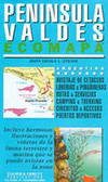 Peninsula Valdes Map $14.95
 -

-
-
-

Hesquiat Peninsula Map

Hover over image to zoom
)
Product Description
A topographic route map for hiking the western shoreline of Hesquiat Peninsula on the west coast of Vancouver Island, BC
Wild Isle Guide Coastal Hiking Series
Hesquiat Peninsula describes a coastal hiking route along the rugged western shoreline of Hesquiat Peninsula on the west coast of Vancouver Island, BC. The route is marked on a 1:50,000 scale topographic map and includes information on distances and hiking times, recommended campsites, tide cutoffs, sources of drinking water and noteworthy features.
Features:
- customized topographic map
- detailed hiking route
- distances and hiking times
- recommended campsites
- tide cutoffs
- sources of drinking water
- 1 km UTM grid lines
- latitude and longitude
- three-dimensional shaded relief
- covers parts of 92E/7, 92E/8, 92E/9 and 92E/10
Hesquiat Peninsula is a customized topographic map based on the Canadian NTS Topographic maps and is printed on water-resistant/tearproof synthetic stock.
Hesquiat Peninsula Hike
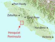
The Hesquiat Peninsula is a west coast promontory of Vancouver Island and divides Clayoquot and Nootka Sounds. The topography of the peninsula is comprised of a low, flat swampy forest rimmed with a stunning geologically diverse shoreline.

The shape of the peninsula is square cut with a long stretch of rocky shoreline running north-south from Burdwood Point, at the entrance to Nootka Sound, to the historic lighthouse at Estevan Point. From Estevan Point the coast turns abruptly 90 degrees west-east across to Smokehouse Bay. At the east end of Smokehouse Bay the shore swings another right angle south-north from Matlahaw Point past Hesquiat village and a series of immense beaches to Boat Basin at the head of Hesquiat Harbour.
Much of the land on the Hesquiat Peninsula is now Provincial Park, from Escalante Point all the way around to Hot Springs Cove which is part of Maquinna Marine Park. This region is ancestral home of the Hesquiat First Nation, of the west coast Nuu-chah-nulth people, and there are residents at the tiny outpost of Hesquiat Village. Points of interest along the route include the beaches at Escalante, Estevan Point lighthouse, Hesquiat Village, beaches around Anton’s Spit and Cougar Annie’s Garden in Boat Basin.