 Loading... Please wait...
Currency Displayed in
- Home
- Maps By Sport
- Hiking Maps
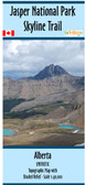
- Jasper National Park South - Hiking Trails Map - SYNTHETIC
Categories
Related Products


Jasper National Park South - Hiking Trails Map - SYNTHETIC

Hover over image to zoom
)
Product Description
Map of Jasper National Park South from Jasper to Banff National Park. Scale 1:125,000 with Shaded Relief. Contours in 100m and 500m intervals
The map shows Official 2024 National Park Trails along with the non-maintained trails leading off the edge of the park and distances between trail junctions or the various icons on the map.
Shows the locations of campsites with coordinates in decimal degrees and UTM.
Shows Warden Cabins, Accommodations, and parking areas.
Includes an insert showing the trails around the townsite of Jasper.
This map measures 41.5" x 36 inches.
It is printed on waterproof/synthetic paper and comes folded in a plastic sleeve.
This map replaced the Maligne-Jasper Map in the Spring of 2024