Loading... Please wait...

Categories

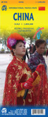
China Mongolia Travel Map

Hover over image to zoom

  • China on a double-sided map at 1:3,000,000 from Freytag & Berndt, with a separate booklet attached to the map cover containing an index and street plans of central Beijing, Lhasa, Shanghai, Hong Kong, Taipei, Ulaanbaatar and Kathmandu. Coverage includes the whole of Mongolia, the Koreas, Nepal and Bhutan, also northern Burma with Mandalay, Indian Himalaya with Delhi, etc. Place names are in the Latin alphabet (except for larger towns within Russia, also shown in the Cyrillic). 

Topography of the whole region is well presented, particularly in Tibet and Xingjian, by relief shading and spot heights, with plenty of names of mountain ranges, peaks, deserts, etc. Road network gives distances on main routes. Railway lines are included and local airports are marked; the map also shows shipping routes. Also shown are internal administrative boundaries and names of the provinces. A range of small icons highlight various places of interest. Latitude and longitude lines are drawn at 1º intervals. The index, in a separate booklet attached to the map cover is arranged by country. Multilingual map legend includes English.
Freytag
$11.95
SKU:
AK127
Weight:
0.20 KGS

 Product Description

Freytag folded road map of China & Mongolia at 1:4,000,000 with index & distances in km and inset map for Beijing (16"x8"). Best quality map of its kind to buy for travels to China and Mongolia.

China on a double-sided map at 1:3,000,000 from Freytag & Berndt, with a separate booklet attached to the map cover containing an index and street plans of central Beijing, Lhasa, Shanghai, Hong Kong, Taipei, Ulaanbaatar and Kathmandu. Coverage includes the whole of Mongolia, the Koreas, Nepal and Bhutan, also northern Burma with Mandalay, Indian Himalaya with Delhi, etc. Place names are in the Latin alphabet (except for larger towns within Russia, also shown in the Cyrillic). 

Topography of the whole region is well presented, particularly in Tibet and Xingjian, by relief shading and spot heights, with plenty of names of mountain ranges, peaks, deserts, etc. Road network gives distances on main routes. Railway lines are included and local airports are marked; the map also shows shipping routes. Also shown are internal administrative boundaries and names of the provinces. A range of small icons highlight various places of interest. Latitude and longitude lines are drawn at 1º intervals. The index, in a separate booklet attached to the map cover is arranged by country. Multilingual map legend includes English.

 Find Similar Products by Category

You Recently Viewed...


newsletter

Copyright 2024 GoTrekkers. All Rights Reserved.
 Sitemap | Ecommerce Website Design by High Country Web Design.