Loading... Please wait...

Categories

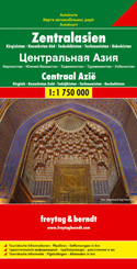
Central Asia Travel Map

Hover over image to zoom

  • Central Asia at 1:1,500,000 on a large map from Freytag and Berndt with a separate index booklet attached to the map cover also providing street plans of central Asgabat, Astana, Bishkek, Dushanbe and Tashkent. 

The map covers the whole of Uzbekistan, Tajikistan and Kyrgyzstan, plus most of Turkmenistan and southern Kazakhstan. Topography of the area is very effectively presented by relief shading, with plenty of names of geographical features such as mountain chains, peaks, valleys, deserts, etc, and additional graphics for forests, salt flats, swamps, wells in arid areas, sandy or rocky deserts, etc. National parks and other protected areas are highlighted. 

Road network indicates four different types of roads, including desert tracks, and indicates distances on main routes and locations of border crossings. The course of the various variants of the Silk Road is prominently marked. Railway lines are included and local airports are marked. The map also shows oil pipelines and internal administrative boundaries with names of the provinces. Symbols indicate various places of interest including UNESCO World Heritage sites. Latitude and longitude lines are drawn at 1° intervals. Multilingual map legend includes English. 

The index, arranged by country, is in a separate booklet attached to the map cover. The booklet also provide street plans (each covering two pages of Asgabat, Astana, Bishkek, Dushanbe and Tashkent. The plans highlight principal traffic arteries and give names of other main streets as well as various places of interest. 

Place names on the map and the street plans are shown transliterated into Latin alphabet, with some larger cities given alternative spellings (Toshkent/Taschkent) or shown in Cyrillic alphabet.
  • Image 3
Freytag
$9.95
SKU:
AK155
Weight:
0.20 KGS

 Product Description

Folded road map of Central Asia, Kyrgystan, Southern Kazakhstan, Tajikistan, Turkmenistan, Uzbekistan with tourist information, pipelines & distances in km

Central Asia at 1:1,500,000 on a large map from Freytag and Berndt with a separate index booklet attached to the map cover also providing street plans of central Asgabat, Astana, Bishkek, Dushanbe and Tashkent. 

The map covers the whole of Uzbekistan, Tajikistan and Kyrgyzstan, plus most of Turkmenistan and southern Kazakhstan. Topography of the area is very effectively presented by relief shading, with plenty of names of geographical features such as mountain chains, peaks, valleys, deserts, etc, and additional graphics for forests, salt flats, swamps, wells in arid areas, sandy or rocky deserts, etc. National parks and other protected areas are highlighted. 

Road network indicates four different types of roads, including desert tracks, and indicates distances on main routes and locations of border crossings. The course of the various variants of the Silk Road is prominently marked. Railway lines are included and local airports are marked. The map also shows oil pipelines and internal administrative boundaries with names of the provinces. Symbols indicate various places of interest including UNESCO World Heritage sites. Latitude and longitude lines are drawn at 1° intervals. Multilingual map legend includes English. 

The index, arranged by country, is in a separate booklet attached to the map cover. The booklet also provide street plans (each covering two pages of Asgabat, Astana, Bishkek, Dushanbe and Tashkent. The plans highlight principal traffic arteries and give names of other main streets as well as various places of interest. 

Place names on the map and the street plans are shown transliterated into Latin alphabet, with some larger cities given alternative spellings (Toshkent/Taschkent) or shown in Cyrillic alphabet.

 Find Similar Products by Category

You Recently Viewed...


newsletter

Copyright 2025 GoTrekkers. All Rights Reserved.
 Sitemap | Ecommerce Website Design by High Country Web Design.