 Loading... Please wait...
Currency Displayed in
- Home
- Travel Maps
- Caucasus Travel Map
Categories
Related Products
-
 Victoria Map Travel Map $9.95
 -

-

-
 Bolivia Map Travel Map $9.95
 -
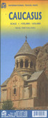 Caucasus Travel Map itmb $9.95

Caucasus Travel Map

Hover over image to zoom
)
Product Description
Freytag Bernt map of Caucasus Georgia Armenia Azerbaijan scale 1:700,000 showing index, distances in km.
The Caucasus countries, Georgia, Armenia and Azerbaijan, on an indexed road map from Freytag and Berndt, with coverage of the adjoining Russian republics of Chechnya, Northern Ossetia, Kabardino-Balkaria and Karachaevo-circassia.
International borders and internal administrative boundaries are clearly shown, indicating Southern Ossetia and Abkhazia in Georgia, as well Nagorno-Karabakh and the Azerbaijani enclave within Armenia. Names of larger towns in Georgia, Armenia and Russia are also given in each country’s alphabet.
Topography is shown by relief shading and numerous spot heights, plus names of many chains within the Caucasus Mountains. Road network shows border crossings and driving distances on primary routes, and includes many secondary local roads and tracks. Railway lines and local airports are also shown.
Symbols mark main places of interest including World Heritage sites, and national parks or nature reserves are highlighted. The map has latitude and longitude lines at intervals of 1º. The index is in a separate booklet attached to the map cover.