 Loading... Please wait...
Currency Displayed in
- Home
- Travel Maps
- Canada Western itmb Travel Map
Categories
Related Products
-
 Canada itmb Travel Map $9.95
 -
 France itmb Travel Map $9.95
 -
 Mongolia itmb Travel Map $9.95
 -
 Panama itmb Travel Map $9.95
 -
 Turkey itmb Travel Map $9.95

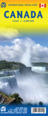
Canada Western itmb Travel Map

Hover over image to zoom
)
Product Description
This is actually our second attempt at mapping the western portion of Canada; the first covered everything from northwestern Ontario to the Pacific Ocean and, while it was an excellent map, the scale that such a huge area covered necessitated severe problems. In this version, all of British Columbia, Alberta, and the Yukon have been mapped from fresh digital data and presented at 1:1.4T scale. This would have been impossible when we prepared the first map. The Northwest Territories portion had to be compressed in two ways; first, the scale is 1:2M; second, only the portion with roads is shown. This is still an extremely large area. One has to consider the actual size of Canada when designing a map. Most countries in Europe would fit into this area, which only covers 20 percent of Canada. The Fort McMurray forest fire of a year ago covered an area larger than France, and Cyprus would fit nicely into Great Slave Lake, if it had Malta to keep it company. Because size is so important when mapping Canada, we compromised and followed the norms used by our competitors in deciding what Western meant to potential buyers, who are probably visitors to this country and are unaware of its vastness. The norm appears to be the two westernmost provinces of BC and Alberta and the Yukon Territory. Given that parameter, the map fits nicely as a double-sided map, with the provinces on one side and the two territories on the other. I should advise that more detailed separate provincial/territorial maps are available. Roads are shown, but the new road under construction north of Inuvik is being created under extremely trying circumstances, and until it is actually open to traffic, we have opted to show it as a winter road only. Once this marvel of tundra engineering is open for vehicle use, it will be possible to drive from the Arctic Ocean to the Panama Canal, something that is not possible to do now. Please note that the Western Canada Travel Atlas continues in print, as its book format allows us to portray a larger area of coverage.
Map size: 27*39"