Loading... Please wait...

Categories

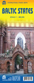
Baltic States Travel Map

Hover over image to zoom

  • Double-sided, road map showing intermediate driving distances on many routes. Road detail includes secondary roads, and toll roads and scenic routes are highlighted. Other details: ferries & railways, symbols for airports, ports, major filling stations & service stations, telecommunications towers, monuments, castles, border crossings, campsites. Nature reserves are highlighted in green. Names are printed in Cyrillic text for the Russian territory on the map.
Map legend includes English. Index booklet attached to map cover includes central street plans for Tallin, Riga & Vilnius.
  • Double-sided, road map showing intermediate driving distances on many routes. Road detail includes secondary roads, and toll roads and scenic routes are highlighted. Other details: ferries & railways, symbols for airports, ports, major filling stations & service stations, telecommunications towers, monuments, castles, border crossings, campsites. Nature reserves are highlighted in green. Names are printed in Cyrillic text for the Russian territory on the map. 
Map legend includes English. Index booklet attached to map cover includes central stret plans for Tallin, Riga & Vilnius.
Freytag
$12.95
SKU:
AK8101
Weight:
0.20 KGS

 Product Description

Freytag double-sided, folded road map of the Baltic States at 1:400,000 with city maps for Hamburg, Helsinki, Copenhagen, Oslo, Riga, St. Petersburg, Stockholm and Tallinn, tourist information and index with postal codes. Great quality travel map to buy for your travels through the Baltic Sea States.

Double-sided, road map showing intermediate driving distances on many routes. Road detail includes secondary roads, and toll roads and scenic routes are highlighted. Other details: ferries & railways, symbols for airports, ports, major filling stations & service stations, telecommunications towers, monuments, castles, border crossings, campsites. Nature reserves are highlighted in green. Names are printed in Cyrillic text for the Russian territory on the map. 
Map legend includes English. Index booklet attached to map cover includes central stret plans for Tallin, Riga & Vilnius.

 Find Similar Products by Category

You Recently Viewed...


newsletter

Copyright 2024 GoTrekkers. All Rights Reserved.
 Sitemap | Ecommerce Website Design by High Country Web Design.