 Loading... Please wait...
Currency Displayed in
- Home
- Travel Maps
- Baja North Travel Map
Categories
Related Products
-
 Serbia North Travel Map $9.95
 -
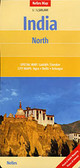 India North Travel Map $9.95
 -
-
 Mexico North Travel Map $9.95
 -
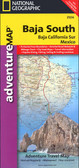 Baja South Travel Map $9.95

Baja North Travel Map

Hover over image to zoom
)
Product Description
Northern Baja California on double-sided, waterproof and tear-resistant, GPS compatible Adventure Map at 1:450,000 from the NGS, with street plans of Tijuana, Mexicali and Ensenada and extensive tourist information.
Topography is shown by contours at 100m intervals, enhanced by subtle relief shading, spot heights and graphics for marshlands to provide a very clear presentation of the terrain. Additional colouring shows forested areas. National parks and other protected areas are prominently marked.
Graded presentation of the road network distinguishes between gravel and dirt roads. Locations of fuel supplies are marked, indicating separately petrol and diesel stations. No driving distances are shown, but a distance table is provided on each side of the map. Railway lines are shown and local airports are marked. The map also indicates time zones.
Symbols highlight various places of interest, including beaches, diving and surfing sites, fishing kayaking and windsurfing, historical monuments, etc. The map has both a UTM grid and latitude/longitude margin ticks at intervals of 15’. A very short index lists only the area’s larger towns. Map legend is in English and Spanish.
Street plans at 1:25,000 cover central areas of Tijuana, Mexicali and Ensenada, highlighting various facilities and places of interest. The map also includes background information on the region’s history, culture and environment, etc.