 Loading... Please wait...
Currency Displayed in
- Home
- Maps By Sport
- Canoe Maps Canada
- Atlin/ Áa Tlein Téix’i Provincial Park map
Categories
Related Products
-
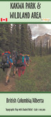 Kakwa Provincial Park map $22.00
 -
-
-
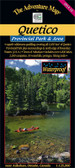 Quetico Provincial Park Map $15.95
 -
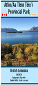

Atlin/ Áa Tlein Téix’i Provincial Park map

Hover over image to zoom
)
Product Description
Atlin/ Áa Tlein Téix’i Provincial Park map shows the park at a scale of 1:100,000 with shaded relief and has the dimensions of 41.5" x 27"
The map shows the main hiking trails within the park. It has two inserts showing the town of Atlin and area and the Burdette Creek Hut with both the summer hiking trail and winter ski/snowmobile trails. The map also includes the Mount Adams trail to the spectacular views of the Llewellyn Glacier.
The map includes the campgrounds within the park and campsites out on Atlin Lake.
The map is printed on paper and comes folded in a protective plastic sleeve.
Cover photo used under license from Stefan Voswinkel/Shutterstock