 Loading... Please wait...
Currency Displayed in
- Home
- Maps By Sport
- Hiking Maps
- Adventure Map Central Chile Argentina Trekking Map
Categories
Adventure Map Central Chile Argentina Trekking Map
Product Description
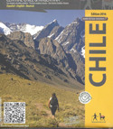
The first cross-border map of Central Chile and the adjacent area in western Argentina. The map shows the circular route Santiago - Talca - Paso Pehuenche - Malargüe - Mendoza and refers to many attractions and outdoor activities along this route as well as on the Pacific coast. These include cycling routes as that of Talca over the Pehuenche Pass to Malargüe (Argentina), as well as hiking and climbing areas, ski resorts, surf beaches, thermal springs etc. QR codes connect with tour descriptions within the App Trekkingchile. Map elaborated by the Cartographic Institute of Dresden Technical University. GPS-compatible, with multicolored elevation profile. Printed on tear- and water-resistant, environmentally friendly Stone Paper. Trekkingchile, 1st edition 2016 Road & travel map, bicycle map, Central Chile, scale 1:500.000 English - German - Spanish. - See more at: http://maps.trekkingchile.com/chile-central/adventure-chile


