 Loading... Please wait...
Currency Displayed in
- Home
- Maps By Sport
- Canoe Maps Canada
- Yukon River Mapbook - Marsh Lake to Dawson City
Categories
Related Products
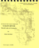


Yukon River Mapbook - Marsh Lake to Dawson City

Hover over image to zoom
)
Product Description
Yukon River - Marsh Lake to Dawson City
This color covered map guide includes 172 photos, past and present to enhance the trip. Retrace the historic Gold Rush route of 1898. Being one of the most popular canoe trips in the Yukon, you are sure to encounter other wilderness river enthusiasts. Remnants of the early gold rush and river steamer days abound along this famous waterway. Paddle, float or motor down the river of gold through such immortal spots as Whitehorse, Five Finger Rapids, Lake Laberge, Fort Selkirk and Dawson City. The infamous rapids at Five Fingers and Rink are easily run using the proper channels and a certain degree of common sense.
Travelers from around the world return annually to run this colorful river, and with their new found canoeing experience return to canoe its tributaries. This wide, fast river, with its well-spaced supply centers, lends itself to family, school and outdoor groups. Due to the convenience of the access/egress points, trips of varying lengths, ranging from 1 day to 2 weeks can be planned. By river, it is 752 kilometers (467 miles) from Marsh Lake to Dawson.
The maps are at an approximate scale of 1:65,000 and include current and historic site names, details of all river impediments, geographic identifiers, possible campsite locations, and GPS coordinates on every page. This publication also includes the history of the river (including the Yukon River portion), a detailed description of the river itself, suggestions for equipment and a detailed bibliography for further reading for history buffs.