 Loading... Please wait...
Currency Displayed in
- Home
- Maps By Sport
- Hiking Maps
- Waterton Lakes National Park map
Categories
Related Products
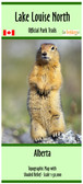


Waterton Lakes National Park map

Hover over image to zoom
)
Product Description
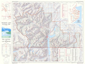
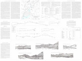
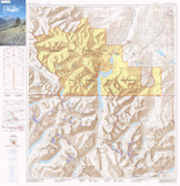
Topographic Map of Waterton Lakes National Park, Alberta, Canada. scale 1:40,000 with Shaded Relief.
This map is about 43" x 27" single sided showing 81 Official Parks trails. Map has 20m contours
Map is printed on paper and comes folded in its own protective plastic sleeve.