 Loading... Please wait...
Currency Displayed in
- Home
- Maps By Sport
- Hiking Maps
- The President and Area map
Categories
Related Products
-
 Ghost River Area map $24.95
 -
 The Royal Group Area map $24.95
 -
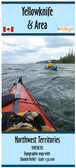
 Yellowknife & Area Map $22.00
 -
 Ram Falls Area map $24.95
 -

The President and Area map

Hover over image to zoom
)
Product Description
Map of "The President" mountain area, Canada, BC, scale 1:15,000.
Topographic map at 1:15,000 with shaded relief of "The President" area in Yoho Park. 25m & 100m contours. 36"x34". Cover from just north of the Twin Falls Chalet to Emerald Lake in the south. From just east of Wapta Mtn in the east to the Kiwetinok Ridge in the west.