Loading... Please wait...

Categories

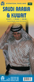
Saudi Arabia Travel Map

Hover over image to zoom

  • The Arabian Peninsula with Saudi Arabia, Yemen, Oman, United Arab Emirates, Qatar, Bahrain and Kuwait at 1:2,000,000 on a large, double-sided, indexed map which also covers most of Iraq and Jordan, plus southern Iran.

The map divides the peninsula north/south with a generous overlap between the two sides. Relief shading with spot heights and graphics sandy or rocky deserts, salt flats and lakes, seasonal streams, etc. indicates the topography. Plenty of names of geographical features are provided and the map also shows locations of oil fields.

Road network includes desert tracks and gives intermediate driving distances on main and most secondary routes. Railway lines are included and local airports are marked. A range of symbols highlights various places of interest. All place names are shown in Latin alphabet only. The map has latitude and longitude lines at intervals of 1°. Multilingual map legend includes English. The index is in a separate booklet attached to the cover.
Freytag
$11.95
SKU:
AK106
Weight:
0.20 KGS

 Product Description

Freytag double-sided, folded road map of Saudi Arabia (1:2,000,000) with tourist information, index & distances in km. Best quality, accurate and up-to-date road map to buy for tourists and business visitors travelling in the Kingdom of Saudi Arabia area.

The Arabian Peninsula with Saudi Arabia, Yemen, Oman, United Arab Emirates, Qatar, Bahrain and Kuwait at 1:2,000,000 on a large, double-sided, indexed map which also covers most of Iraq and Jordan, plus southern Iran.

The map divides the peninsula north/south with a generous overlap between the two sides. Relief shading with spot heights and graphics sandy or rocky deserts, salt flats and lakes, seasonal streams, etc. indicates the topography. Plenty of names of geographical features are provided and the map also shows locations of oil fields.

Road network includes desert tracks and gives intermediate driving distances on main and most secondary routes. Railway lines are included and local airports are marked. A range of symbols highlights various places of interest. All place names are shown in Latin alphabet only. The map has latitude and longitude lines at intervals of 1°. Multilingual map legend includes English. The index is in a separate booklet attached to the cover.

 Find Similar Products by Category

You Recently Viewed...


newsletter

Copyright 2024 GoTrekkers. All Rights Reserved.
 Sitemap | Ecommerce Website Design by High Country Web Design.