 Loading... Please wait...
Currency Displayed in
- Home
- Maps By Sport
- Canoe Maps Canada
- Sandy River Map - SYNTHETIC
Categories
Related Products
-

-

-
 Sandy River Map $22.00
 -
 Cree River 2 Map - SYNTHETIC $30.95
 -

Sandy River Map - SYNTHETIC

Hover over image to zoom
)
Product Description
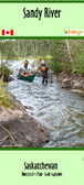
Map of Sandy River, Saskatchewan. scale 1:40,000.
Map is of the Sandy River nestled between Black Bear Island Lake on the Churchill River (Churchill River 05 map) and the Paull River above Tuck Falls. Made with information provided by Churchill River Canoe Outfitters. Scale 1:40,000 Size 31" x 21"
Printed on waterproof paper