 Loading... Please wait...
Currency Displayed in
- Home
- Travel Maps
- Rhodes Travel Map
Categories
Related Products
-
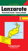 Lanzarotte Travel Map $9.95
 -
 Victoria Map Travel Map $9.95
 -

-

-
 Bolivia Map Travel Map $9.95

Rhodes Travel Map

Hover over image to zoom
)
Product Description
Freytag folded road and leisure map of Rhodes at 1:50,000 with index, inset map of Halki, Orm Kerameni, tourist information, attached culture guide booklet with great general and tourist information and colour photos. Great map to buy for your trip to Rhodes, Greece.
Rhodes on a large indexed map from Freytag & Berndt, including a booklet with multilingual descriptions of the island’s main sights. Although the scale is 1:50,000 and the map is contoured, it is better suited for exploring the island by car rather than for hiking.
Coverage includes Symi and Halki with Alimia, shown on separate insets. Contours enhanced by bold relief shading and colouring indicating woodlands show the topography. Road network includes local tracks and gives distances on most routes. Scenic routes are prominently highlighted.
Large icons indicate various places of interest, highlighting locations with are given multilingual descriptions in the booklet attached to the map cover. The map has a 5-km UTM grid, plus margin tick and crosshairs for latitude and longitude at intervals of 2’. The booklet also includes an index plus a street plan of central Rhodes Town with its historic Old City. Multilingual map legend includes English.