Loading... Please wait...

Categories

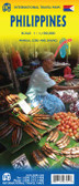
Philippines Travel Map

Hover over image to zoom

  • Philippines at 1:900,000 on a double-sided, indexed map from Freytag & Berndt with ferry connections for island hopping and icons prominently highlighting numerous places of interest, locations with tourist accommodation including campsites, etc. The map divides the country north/south, with Batan and Babuyan Islands north of Luzon shown as an inset at the same scale as the main map, and the Sulu Archipelago in the far south presented at 1:1,500,000. 

Topography is indicated by relief shading with spot heights and names of mountain ranges, peaks, etc. Throughout the whole country numerous smaller islands are named. The map shows the network of road and rail connections on the islands, as well as ferry connections and local airports. Also marked are internal administrative boundaries with names of the provinces. Icons indicate various places of interest including national parks and other protected areas, UNESCO World Heritage sites and other historical sites, temples, etc. The map is indexed and has latitude and longitude lines at intervals of 1°. Map legend includes English.
Freytag
$11.95
SKU:
AK133
Weight:
0.20 KGS

 Product Description

Freytag folded road map of the Philippines at 1:950,000 with tourist information, ferries and index. Best quality map of its kind to buy for travelling through the Philippines.

Philippines at 1:900,000 on a double-sided, indexed map from Freytag & Berndt with ferry connections for island hopping and icons prominently highlighting numerous places of interest, locations with tourist accommodation including campsites, etc. The map divides the country north/south, with Batan and Babuyan Islands north of Luzon shown as an inset at the same scale as the main map, and the Sulu Archipelago in the far south presented at 1:1,500,000. 

Topography is indicated by relief shading with spot heights and names of mountain ranges, peaks, etc. Throughout the whole country numerous smaller islands are named. The map shows the network of road and rail connections on the islands, as well as ferry connections and local airports. Also marked are internal administrative boundaries with names of the provinces. Icons indicate various places of interest including national parks and other protected areas, UNESCO World Heritage sites and other historical sites, temples, etc. The map is indexed and has latitude and longitude lines at intervals of 1°. Map legend includes English.

 Find Similar Products by Category

You Recently Viewed...


newsletter

Copyright 2024 GoTrekkers. All Rights Reserved.
 Sitemap | Ecommerce Website Design by High Country Web Design.