 Loading... Please wait...
Currency Displayed in
- Home
- Maps By Sport
- Hiking Maps
- Okanagan High Rim Trail - SYNTHETIC
Categories
Related Products
-

-

-

-
 Okanagan High Rim Trail $17.95
 -
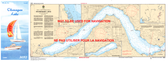 3052 - Okanagan Lake $18.00

Okanagan High Rim Trail - SYNTHETIC

Hover over image to zoom
)
Product Description
Okanagan High Rim Trail located between Vernon and Kelowna, British Columbia. The map has a scale of 1:50,000 with shaded relief and dimensions of 12 x 41.5"
The map shows the trailheads, campsites and view points with location coordinates.
The map is printed on synthetic/ waterpoof paper and comes folded in a protective plastic sleeve.
The making of this map would not have been possible without the help of Valhalla Pure Outfitters in Vernon, BC
What started as the vision of an Okanagan Valley trail network by retired forester, Bruce Somner, became known as the Okanagan High Rim Trail. Several organizations were instrumental in the development and maintenance of this trail, and only in 2017, through the dedication of several
enthusiasts, this organization was born. It was established to maintain, improve and promote the High Rim Trail, from Vernon, BC to Kelowna BC.
The Okanagan High Rim Trail traverses the ancestral, traditional land, and unceded territory of the Syilx (Okanagan) people. They have lived on this land for thousands of years and we acknowledge them as the past, present, and future caretakers of this land. We honour with gratitude, the land itself and the people.